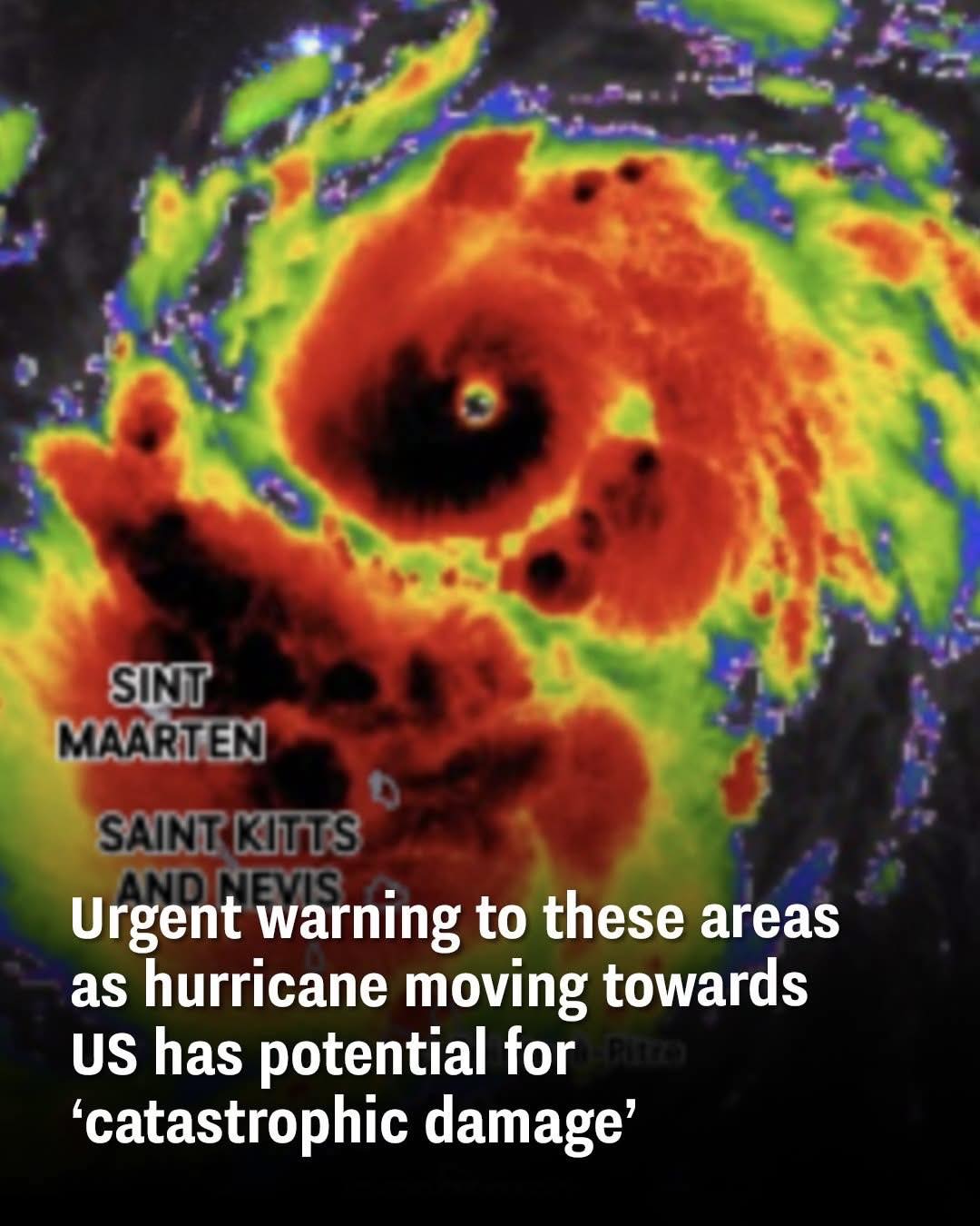
Atlantic Ocean — Officials are sounding urgent alarms as Hurricane Erin, one of the most powerful storms of the season, continues to gain strength while moving across the Atlantic. The storm has already reached recorded wind speeds of 160 mph, briefly making it a Category 5 hurricane, the most severe classification on the Saffir-Simpson scale.
The storm’s intensity has put coastal regions of the Bahamas, the eastern United States, and Atlantic Canada on high alert as emergency planners prepare for the possibility of catastrophic impacts.
From Category 1 to Category 5 in Just 24 Hours
Hurricane Erin’s rapid intensification has stunned forecasters. Initially classified as a Category 1 hurricane with winds of 75 mph, it strengthened dramatically within a single day to become a Category 5 storm — a rare occurrence in the Atlantic. According to the National Hurricane Center (NHC), only 43 Category 5 hurricanes have ever been recorded in the region.
“Category 5 hurricanes bring catastrophic destruction,” the NHC warned in its Saturday update. “Well-built framed homes can sustain severe damage with loss of most of the roof structure and/or some exterior walls. Power outages could last for weeks to months, and many areas may be uninhabitable for an extended period.”
Dangerous Rip Currents and Coastal Risks
Even as the storm tracks hundreds of miles off the East Coast, its impacts are already being felt. The NHC cautioned that life-threatening surf and rip currents will strike beaches from Florida to New England and extend into Atlantic Canada in the coming week.
“Beaches along the entire East Coast will likely experience rough surf and dangerous rip currents as Erin tracks north and eventually northeast,” explained AccuWeather’s Lead Hurricane Expert, Alex DaSilva.
Particularly vulnerable regions include:
-
North Carolina’s Outer Banks
-
Long Island, New York
-
Cape Cod, Massachusetts
These protruding coastal areas are at the highest risk of flooding and storm surge if Erin shifts closer to shore.
Storm Weakens, but Danger Persists
By early Sunday morning (August 17), Erin had briefly weakened to a Category 3 hurricane, but forecasters warned that conditions could allow the storm to re-intensify back to Category 5 strength in the coming days.
The system is currently expected to remain offshore, though meteorologists caution that any change in track could dramatically increase risks to the U.S. mainland.
A Season of Above-Average Threats
Hurricane Erin is not the only concern this year. The 2025 Atlantic hurricane season has already been forecast as “above average” by the National Oceanic and Atmospheric Administration (NOAA). Predictions call for 13 to 19 named storms, exceeding the historical norm.
With months left before the season closes on November 30, emergency officials are urging residents in coastal regions to remain prepared with evacuation plans, stocked supplies, and reliable access to official weather updates.